Many years ago when I was about twenty-eight I hiked the Inca Trail with a group of friends. The Inca Trail follows the route the Incas forged from their sacred capital of Cusco across the mountains to their royal retreat and citadel at Machu Picchu. Much of the Inca Trail is on actual roadwork built by the Incas hundreds of years ago.
When I hiked the Inca Trail there were few tourists, no porters, no guide nor need for one, and as far as I remember no entrance fee. We took a train from Cusco to kilometre 88 and crossed the Urubamba River, raging in a canyon hundreds of feet below us, on a flying fox (a zip line with a platform to stand on instead of a harness). Then we started walking. Our only guide was a printed, but initially hand-drawn approximation of a map. We were carrying food for the five of us for four days, plus at least one five-litre plastic water container apart from our own water bottles. This was because at one point on the trail we had to carry water, as there would be none available until the next day. We carried only the flysheet from a fairly large tent for shelter. We got lost once because some German tourists came back up the extremely obvious trail ahead of us and assured us it was not the right way (it was), but we spent an hour or two literally climbing cliffs looking for the trail before deciding that the obvious path must be the one. We climbed three mountain passes, the highest being nearly 14,000 feet, and on the fourth day entered Machu Picchu from above, looking down on one of the most astounding sights in the world.
That such a place exists in such a remote and inaccessible location is astonishing, and yet I imagine that to the Incas it was business as usual. They were Andean people so altitude was of no concern, and mountainous terrain was the norm. The entire trail is littered with the ruins of other Inca buildings showing that this was a well-known and much travelled pathway. Machu Picchu never was a hidden city, or a lost city, not to the people of the Andes anyway, though the modern-day “discoverer” Hiram Bingham, who was led there by a young Quechua boy in 1911, would have us believe it was. Never mind that there were Quechua families living and farming there at the time. The Spanish never found it and thus it was never destroyed by them as other Inca sites were. Hiram Bingham thought it was the legendary “lost city” Vilcabamba, the last hold-out of the Incas.
The Incas rose from obscurity in the thirteenth century and through war and/or forming allegiances and/or marriages of convenience with rival chiefs they created the largest pre-Colombian empire in the world, an empire that extended from just across the Colombian border in the north, to Santiago in the south, a distance of approximately five thousand kilometers, and spanning from the eastern Andes to the Pacific coast.
It began with a hundred year drought that threw the separate Andean villages into chaos, warring with each other for food and water. Meanwhile in the fertile Cusco valley there was plenty of water. Instead of fighting each other the Incas, a sub-group of the Quechua people, united, and together built agricultural terraces and irrigation systems, developed food surpluses and an army, and bit by bit expanded their power and control over any who would challenge them.
The empire spread, and lasted for three hundred years. Under Incan rule Andean civilization flourished. They developed and mastered high-altitude agricultural practices. They connected fragmentary roads and built new ones, 30,000 kilometres of roads in all. They were master stonemasons, and I’m frankly dumbfounded by the sheer number of rocks they moved around to create roads, and buildings of all types – houses, palaces, food storage complexes, fortresses, agricultural terraces, and temples. The Inca Quechuas of the rich Cusco Valley rose partly through luck (being in the only place in that part of the Andes that had a good water supply during the drought) and largely through astonishing unity, and organization, and hard work, to become the leaders of a vast empire. It crumbled, though not instantly, with the arrival of the Spanish in the mid 1500’s. The final defeat of the Incas took place in 1572, the end of an astonishing era.
To hike the Inca Trail today costs anywhere from $600 and up. You can only go with an authorized tour company, you must have a guide, numbers are restricted, and you must book months in advance. And there’s now a foot-bridge across the Urubamba River at the start of the trail. There is also the less expensive Salkantay Trail. And then there’s the way we did it.
We took the early train from Ollantaytambo through glorious mountain scenery

to Aguas Calientes, a town at the foot of the ridge on which the ruins of Machu Picchu are situated. From there we expected to take one of the frequent buses travelling the zig-zag road up the mountain to the top. Instead what we found was this:
and this shows only one third of the line-up. We joined the end of the line and discovered that there had been not one, but two rockslides on the road due to heavy rains. Apparently only one had been cleared. Amusing myself while waiting I was drawn to photograph these two boys playing on the sidewalk.
After about an hour the buses started running. About three quarters of the way up the mountain we came to the rockslide at one of the many hairpin bends in the road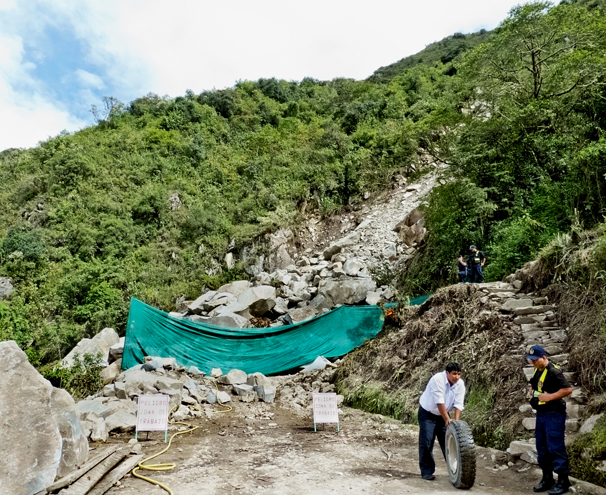
and we all filed out of the bus, climbed the makeshift stairs, that can be seen on the right of the picture, to the road above it and waited in line for a bus to come from the top to get us. At this point Don and I decided to walk. We’d waited in lines long enough. After climbing up the road for twenty minutes, and another twenty climbing Inca stairs and pathways within the complex, we were finally looking at the famous ruins of Machu Picchu.
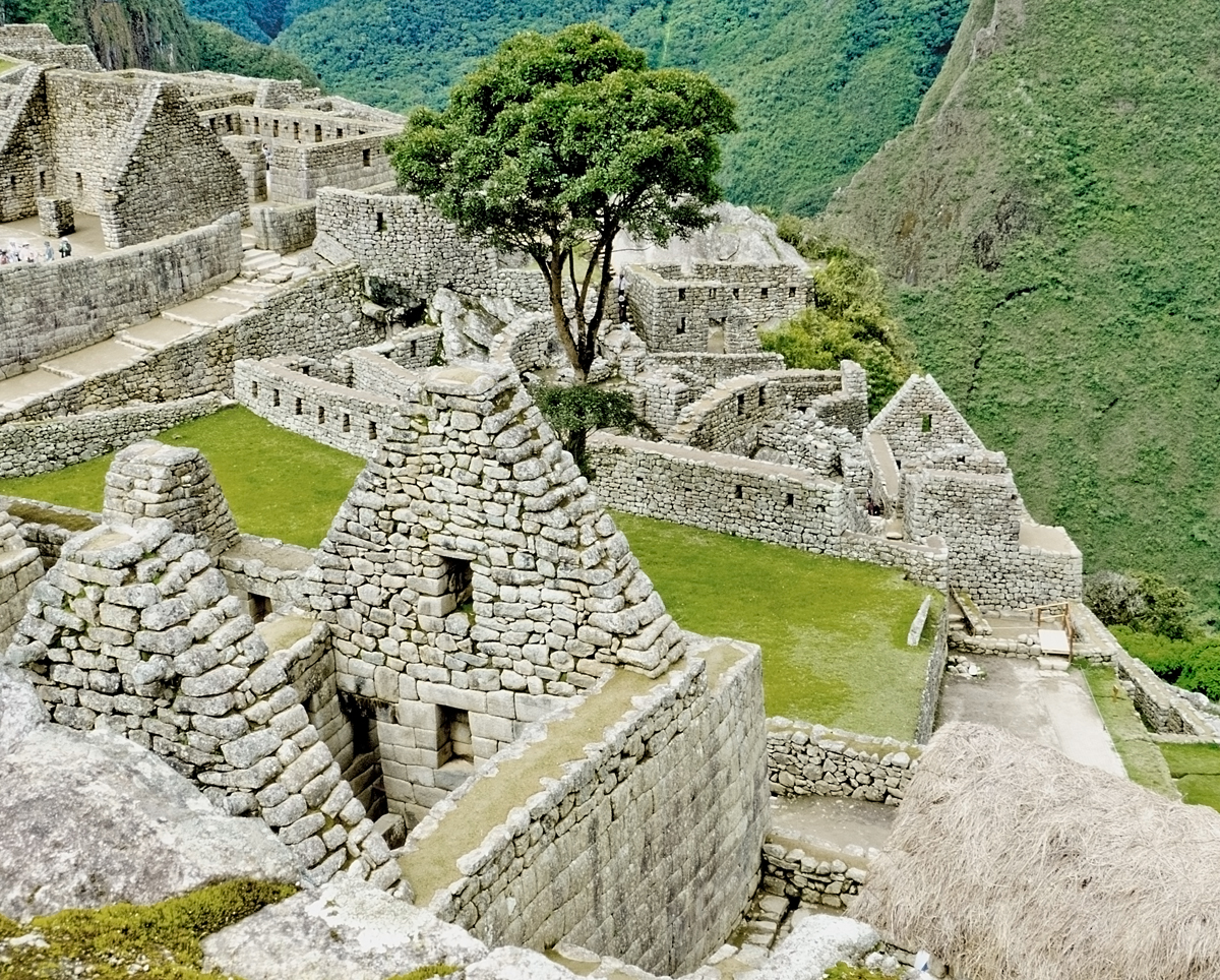
It is believed to have been built in the mid 1400’s. The historians say it was built by Pachacuti Inca Yupanqui, but I rather think it was built by many of his loyal subjects. Emperors rarely, I believe, actually do the dirty work. It is thought to have been a royal retreat, of great spiritual significance, and a fortress that would be extremely difficult to penetrate due to its remote location and difficulty of access.
It housed about 1000 people in 100 family compounds. Apparently the Emperor had the only private bath and toilet on the site.

The Temple of the Sun, above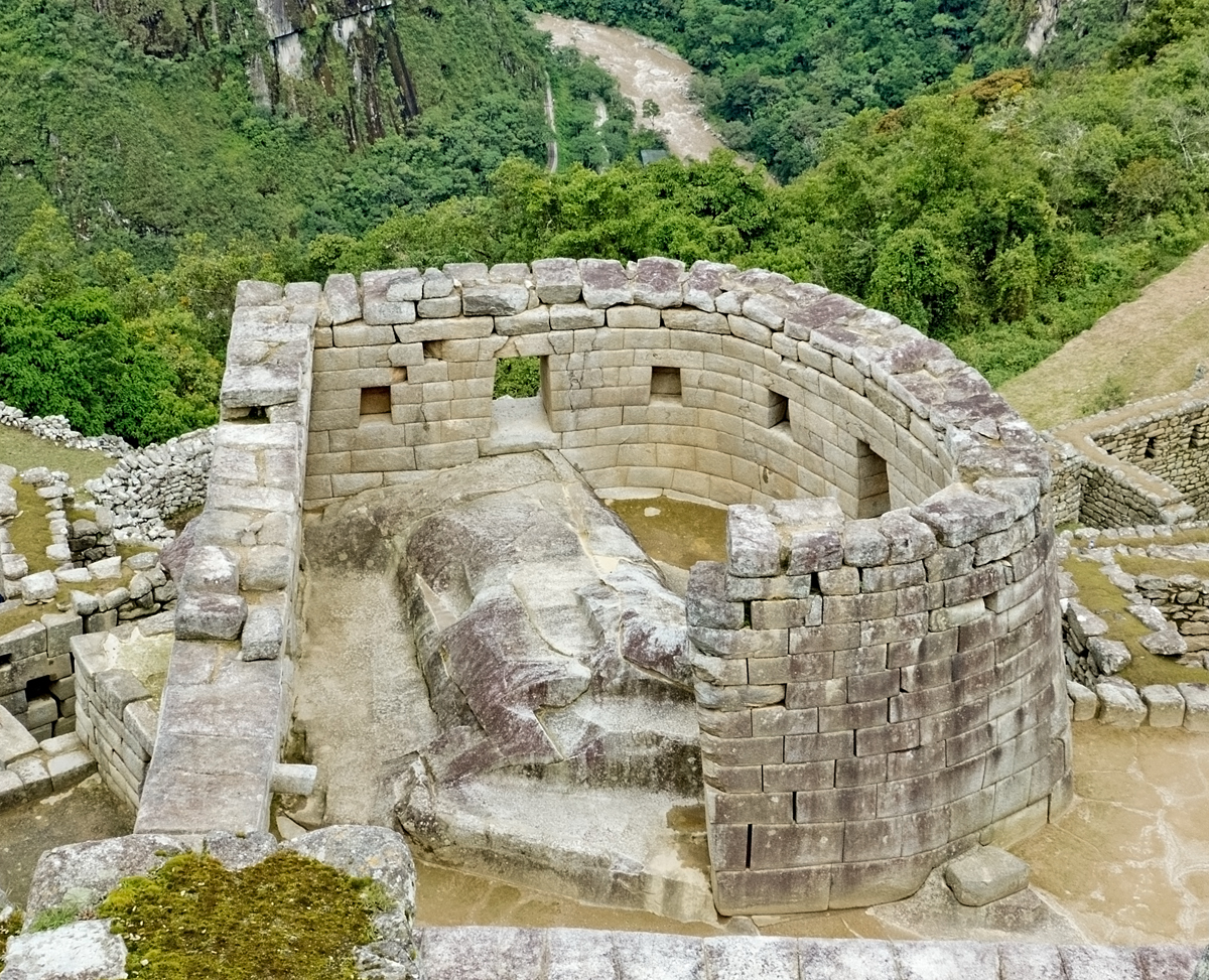
and below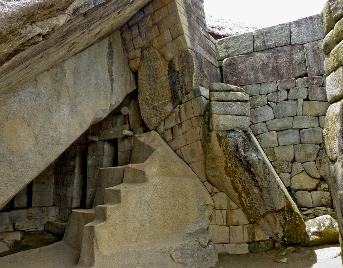
What an extraordinary place it is, huge in scope and power. The Incas lived in rugged intimidating terrain, but instead of being limited by it they used it to shape their cities and citadels, molding the layout and buildings to fit the land that supported them. Rather than fighting the mountains they worshipped them and discovered their secrets. The citadel sits on a ridge between the mountains called Machu Picchu and Huayna Picchu as if it landed gracefully from the sky, in no way in contradiction with the land on which it sits. We were inevitably in awe.
At the end of a long day exploring we were entertained on the train ride back by a fashion parade, and by a wild man who bounced up and down the aisle and on the seats. That woke us up!
The entire Cusco Valley, and Urubamba Valley are littered with Inca ruins. As I’ve said, the Incas spread themselves far and wide, and through their massive building projects left their mark everywhere they went, and Cusco, and the surrounding area, was the cradle of their empire. We visited the ruins at Cusco, Sacsayhuaman, Ollantaytambo, Chinchero, Machu Picchu, Moray and Pisac. And that’s maybe half of what you can see in day trips from Cusco or any number of villages in the area. I’m seriously impressed by all that the Incas achieved, but after seeing the best of them we felt saturated. We reached Inca Ruin burnout, the same as we reached Old Cathedral burnout in Europe. Pisac, however, is worth a mention.
We went as much for the Sunday market as for the ruins. There’s a huge market for tourists selling all kinds of handmade traditional artifacts, most commonly woven and knitted items. Beautiful, and very colourful. Beyond that we found the local fruit and vegetable market. Given all the local markets I’ve seen around the world you’d think I’d have reached Indigenous Market burnout, but apparently not. I still find then fascinating. I’m still entranced by this glimpse into a colourful world where people do things so differently, and yet so very much the same.


From the market we were driven up the mountain to the ruins at Pisac high above the valley. The citadel is surrounded by vast terraces and magnificent panoramic views. Like most Inca cities it is believed to have served military, agricultural, and spiritual purposes, and was possibly built to defend the southern entrance to the Sacred, or Urubamba, Valley. Its Sun Temple is the equal of that at Machu Picchu.
The road winds up from the valley below.
We get out of the car and there above us are the ruins of the Inca city.
Unlike Machu Picchu it is not crowded with other tourists and we revel in being outdoors and climbing and clambering all over the site. Once again we discover that, like the other Inca cities we have visited, it is vast. We walk around for hours knowing we will never see it all, but delighting in what we do see.
The terraces, and views, go on forever.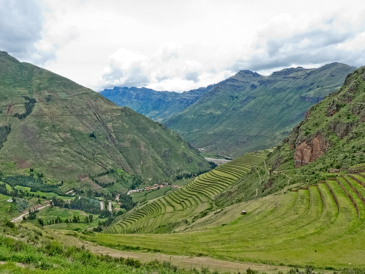
We scramble in and out of what once were homes,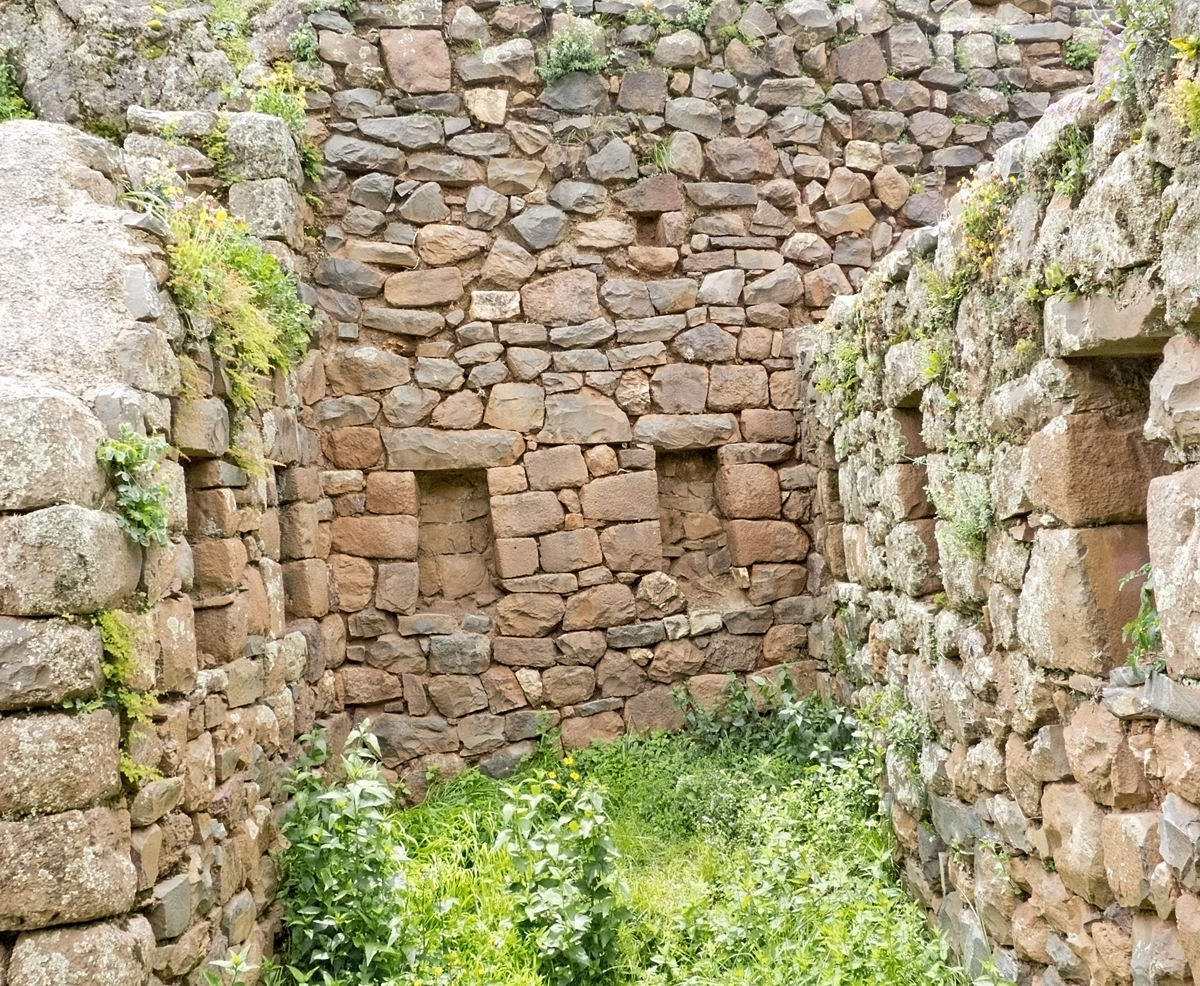
follow pathways
and admire, and climb all over, the Sun Temple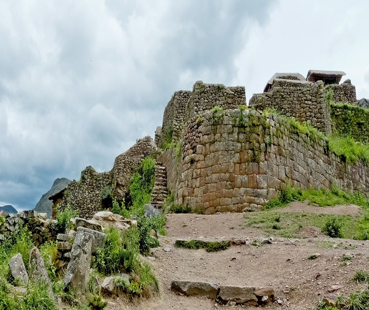

We decided we would walk back down to the village. Online sources say the walk takes variously either forty minutes, or two hours, or anything in between. Weather was threatening. The entire time of our one-hour hike down the mountain there was thunder booming and echoing in the mountains all around us. Lightening flashed frequently, causing us to move more quickly than we otherwise would have. It was scary. And exciting. The path was at times very narrow with a steep drop down one side, at times confusing, at times slippery. We could see another vast rise of terraces and more ruins. There was a river to cross, more than once, but eventually we came to a broad stone staircase going down and down and down and knew that we were on the right path into the village. We passed villagers heading up. I have no idea where they would be going, or why. Our chant was No mas lluvia! No mas lluvia! – No more rain! No more rain!
According to Wiki it is not known when Pisac was built but since the area doesn’t appear to have been previously inhabited it would probably have been during the mid 1400’s. However on the way down the mountain, as well as seeing more ruins that were obviously Incan, we also saw this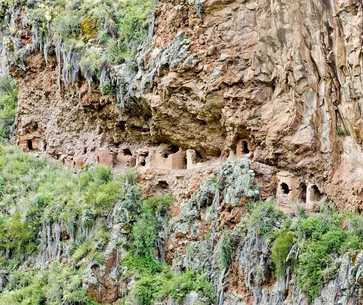
Cliff dwellings. In the middle of a very very high and vertical cliff across the gorge from the trail we were following. Who built them? When and why? And more importantly, how did they ever get up to them from the valley floor way below, or down to them from the top of the cliff way above?
We beat the weather, ate lunch at the highly recommended Blue Llama Café, and were driven back to Cusco in a torrential downpour.
Next post: Fiesta at Ollantaytambo. And a bullfight!
All words and images by Alison Louise Armstrong unless otherwise noted.
© Alison Louise Armstrong and Adventures in Wonderland – a pilgrimage of the heart, 2010-2015.
http://en.wikipedia.org/wiki/Machu_Picchu – Machu Picchu
http://news.nationalgeographic.com/news/2011/07/110721-machu-picchu-100th-anniversary-archaeology-science/ – Machu Picchu
http://travel.nationalgeographic.com/travel/peru/machu-picchu/ – Machu Picchu
http://ngm.nationalgeographic.com/2011/04/inca-empire/pringle-text – Inca origins and history
http://en.wikipedia.org/wiki/P%C3%ADsac – Pisac
http://www.andeantravelweb.com/peru/destinations/cusco/pisac.html – Pisac


Just absolutely splendid! Bravo!
LikeLike
Thanks Cindy. It was fun putting it all together. It made me appreciate the Incas even more. Don and I never do our research beforehand, so doing it afterwards adds a deeper flavour to our memories.
LikeLike
Extraordinary place indeed! I love ruins… it is the only thing that really helps me relate to the history of a place. Have you been to the ruins at Pompeii?
LikeLike
I guess we must love ruins too – we always go to them, everywhere we go. But sadly we missed Pompeii. We were in that part of the world, and all set to go when we discovered the buses weren’t running due to landslides 😦 so we couldn’t get there.
LikeLike
Excellent blog and excellent post! I would recommend it to everyone and everyone but specifically just did so to my mum for some travelling inspiration. Looking forward to more….and more – saludos – Peter
LikeLike
Thank you so much Peter. I’m glad you enjoyed it, and I hope your mum does too. I hope she’s inspired. South America is amazing, but even just Peru has an enormous amount to offer. Lots more to come 🙂
Cheers, Alison
LikeLike
Astonishing…
When we think of the differences and similarities of humans around the globe – I’m fascinated by how differently we’ve ended up dressing – and why?!
Wonderful post thank you, I don’t expect to ever get there but you gave me such a great look around…
LikeLike
Thanks so much – happy to have you along on the journey with us 🙂
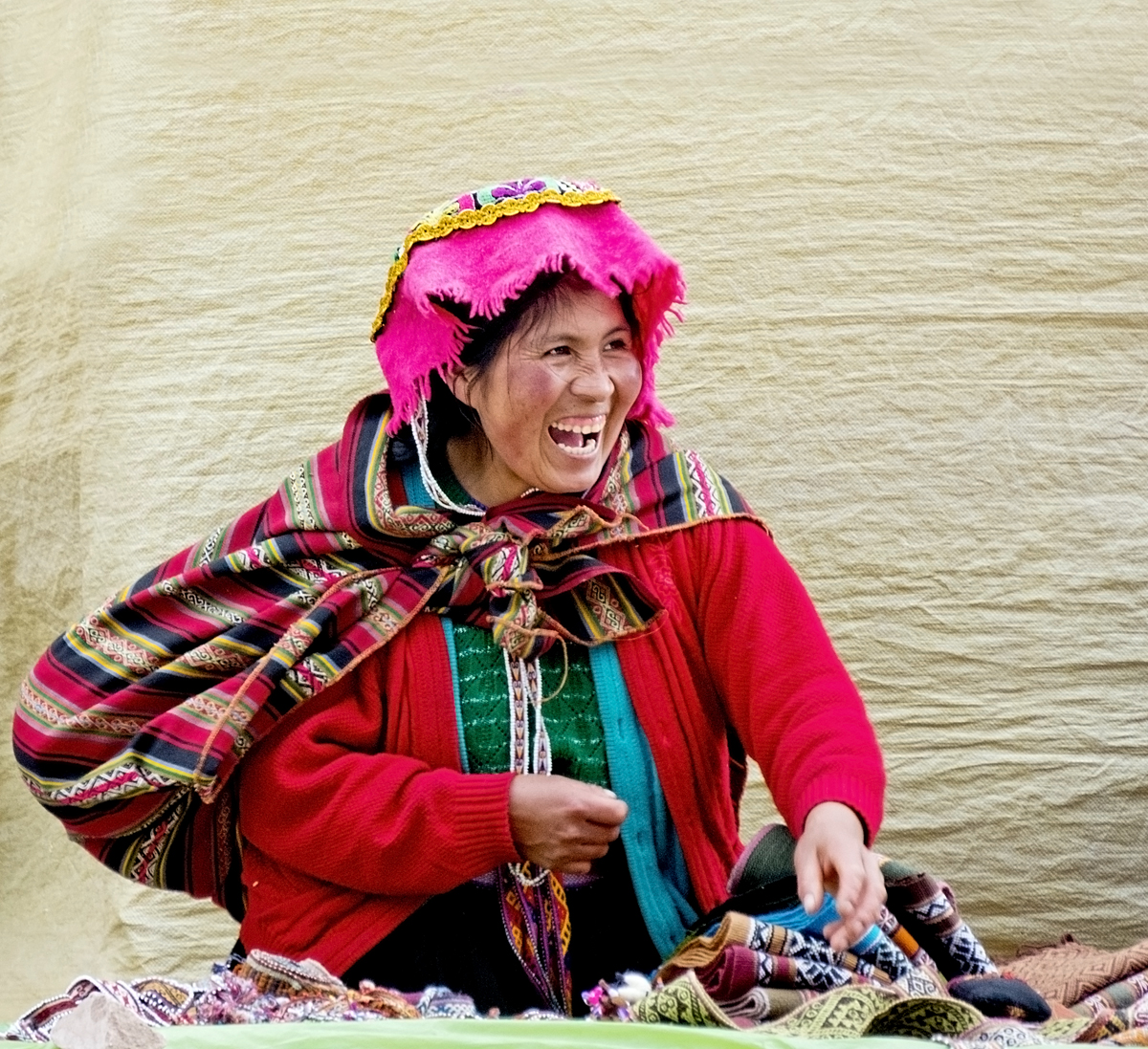
I’m so fascinated with all the clothing styles of indigenous people, all around the world. Almost always so very beautiful. Even thinking of the traditional styles of all the different European peoples before generic western clothing took over. So much colour and beautiful embroidery. And I hear you – it’s all so different from region to region – why? In the pictures above I think the black skirts with wide decorated borders, and the brightly coloured cloth hats are the traditional dress of the Quechua of Pisac, and I guess you saw the post on Chinchero showing the traditional dress of that region. Next post will be about yet another Andean Quechua village, with yet another style. So much beautiful creativity!
LikeLike
Yes, so colourful! The skirts, the cloth hats….and the other hats almost uniform – it’s so interesting!
🙂
LikeLike
I had never heard of Pisac, but it almost looks like a better place to go than Machu Picchu.
LikeLike
I don’t think Pisac is better than Machu Picchu (except in that it is way less crowded), but it is certainly amazing and worth seeing. I’m very glad we went there. It was more than we expected.
LikeLike
Fabulous post! The history you give is great for us who have never been there, and your photos superb. I can only imagine your walk down from Pisac with thunder booming and the lightening! What a fantastic experience.
LikeLike
Thanks so much Angeline. It was interesting for me too to research the history a little bit. We’re so slack about that beforehand so it’s nice to find out about what we looked at. That hike down was great! Scary, but great.
LikeLike
wow… absolutely majestic!! i so envy you right now!!
LikeLike
Thanks K.Z. Majestic is a great word for it. And your day will come 🙂
xox
LikeLike
Incredible! Fantastic photos and your journey…. Inspiring and amazing. Excellent post.
LikeLike
Thanks so very much. The entire Sacred Valley is amazing, and I feel so blessed we got to see so much of it.
LikeLike
Amazing blog !! Thank you I felt like I was there with you !! Keep on keeping on Love Eva
Sent from my iPhone
LikeLike
Thanks Eva. I’m so glad you enjoyed it, and that you were there with us! Hope to see you soon – we’ll be in Van June thru Nov.
LikeLike
Wonderful pictures of an amazing place. Felt like I was there.
LikeLike
Thanks Darlene. I love it when people feel as if they are there with us. Happy to have you along 🙂
LikeLike
what an amazing post. I learn so much from rreading your posts.
LikeLike
Thanks Chris. I guess I felt I had to try to do justice to such an amazing place.
LikeLike
Wonderful photos of an amazing place! Your portraits are terrific. What a great job you did telling its story, Alison.
LikeLike
Thanks so much Naomi. So glad you enjoyed it. It is indeed an amazing place.
LikeLike
Just overwhelmed by your amazing post and stunning photographs! Thank you for sharing. 🙂 cheers!
LikeLike
Thanks Orchid, and thanks for the visit. I’m glad you enjoyed it. Cheers, Alison
LikeLike
Great writing and pictures, as always. I love that you have such a respect for the culture of the people and place, both now and historically. When I was there I found that so many tourists and tour companies did not. I also loved your story of hiking the Camino De Inca back in the day! How I would have that!
LikeLike
Thank you so much Steve. I must admit when I went in my 20’s I didn’t have the perception that I do now. Somehow getting older does that to you 🙂 At least for me anyway it took a bit of living to get to see things with greater depth and respect.
Hiking the trail way back when was indeed one of the highlights of my life. I can’t believe I got to do that.
LikeLike
Marvelous place. Great all of it. Terry’s been there. I’d love to make that trip. Hugs!
LikeLike
Thanks Paulette. It is a marvelous place. Make the trip! 🙂
Hugs to you too, Alison
LikeLike
Simply beautiful. And magnificent. And a little bit sad, too – no “modern” city has ever struck me the way that images of the Incan ruins have. What it must have been like to live in one!
LikeLike
Thanks Felicity. Yes, magnificent is the word. The more Inca ruins we saw the more we were impressed. They were a very advanced people, way ahead of their time in so many ways.
Maybe you did live in one way back when 🙂 and that’s why it speaks to you so deeply. Alison
LikeLike
Great post, Alison and Don. Both Peggy and our son Tony, have been to Machu Picchu. I was jealous before and am doubly so now. Loved the colorful head scarves, BTW. –Curt
LikeLike
Thanks Curt. You have every reason to be jealous 🙂
Curt! They’re not head scarfs! They’re *hats*. Any woman could tell you that! 🙂
LikeLike
Darn, should have asked Peggy. 🙂
LikeLike
Lovely article Alison and Don! I shared it on my FB and G+.
LikeLike
Hi Nicola, thanks very much. I’m glad you enjoyed it. And thanks for sharing it.
I had a look around “Best of Cusco” – lots of really good information there. Anyone going to Cusco could benefit from it.
LikeLike
I do so love the way you relate your travels. Thank you for all the background on the area and being able to see the ruins through your eyes and experiences. Always looking forward to your next adventure.
LikeLike
Thanks so much Joanne. It was very interesting for me to research a bit about the Incas – so often we go exploring places without knowing much about them. I find when I learn a bit it gives me a much deeper appreciation of what I’m seeing. I’m glad you enjoyed it.
LikeLike
Thank you so much for posting this! I have been trying to go to Machu Pichu for the past two years but something always gets in the way. I have plans to make it there next year and this post has some great info.
-Amanda at http://teachingwanderlust.com/
LikeLike
Thanks Amanda, glad you found this helpful. It really is worth going to, but be aware it will be very crowded. Happy travels, Alison
LikeLike
Wonderful post Alison! We also stayed at Ollanta and loved it – fortunately we weren’t faced with recent rockslides and getting over them. We also decided to forgo the cuy – I think it was the teeth! 🙂 ~Terri
LikeLike
Thanks Terri, glad you enjoyed it. Will write some about Ollanta in the next post, beautiful town. We went to a festival there. The cuy – the teeth yes, and that cute little face looking at you – just too much.
LikeLike
Thanks for share helpful Information. I got your nice blog while I was searching about visit Pisac even I was not aware too much. So, now I don’t need to go anywhere to get more information because I got all from your blog the thing I needed.
LikeLike
You’re very welcome Seema. I’m glad you found it helpful. Pisac is wonderful. Happy travels, Alison
LikeLike
Thanks for following Seema. I hope you enjoy the stories of our journey. I looked at your blog – what a great wealth of information, especially about airlines. Thank you so much.
LikeLike
Ahh, those Inca… I remember first learning about them in elementary school and being enthralled. We are always so amazed by the creative outpourings of our fellow human beings. One time is so different from another. I wonder what they would have thought of our portable electronic devices, or soccer, or the Eiffel Tower. I wonder if they would be asking themselves where things went astray!?
And I absolutely love the smiles of the people in your photos. The people in these pictures look like someone has just told them a beautiful and funny secret. Just as we feel amazed by what our fellow humans have created through the ages, and feel as a result we are part of “something”, that is how I feel when I reflect on this “secret” shared by every smiling face. There is something that can be shared with just a glance, “something” to which we are all party.
Michael
LikeLike
I, on the other hand learnt nothing of the Inca in school, choosing to concentrate on pre- Christian European history. My knowledge beyond that is dismal so it’s exciting for me to discover all these other ancient civilizations. And like you, I wonder what it would have been like, how they lived, how they behaved, how they related and loved – or not. Still, it seems the more we are different the more we are the same.
I am always so thrilled when I catch a smile, especially a smile looking at the camera, not being afraid of the camera, or of me, willing to participate and share and connect. I get to be, for a brief moment, a part of their world, a part of their ordinary humanity, and they a part of mine.
Many people in South America, especially the women, believe the camera takes their soul. It can be frustrating for me, and honestly I don’t always respect it, but those moments of connection are like gold. They make my heart sing.
LikeLike
That is interesting about the women thinking the camera takes their soul, because from these images I would say something of the beauty of their inner being is conveyed. But not in a negative way. It is apparent when we see a person smiling, “there is more where that came from”… How can something infinite be taken? On the other hand, I know that distance healers often like to have an image of the person they are working with, no? So, perhaps there is a connection of some sort that is created. Maybe it’s not Polaroid, but Portal-oid… Ha!
They make my heart sing, too.
Michael
LikeLike
Love how this post is organized, Alison. I was so tempted to scroll down to see the photos, but I resisted and was happy I did. The narrative was so poignant and informative. I felt like I was on a metaphorical Inca trail.
Of course the photos were brilliant. I also appreciate the insider look into Pisac.
Funny story about the Inca trail. A friend of mine from Australia didn’t read any guidebooks and charged down the trail in shorts and a sweatshirt with only one bottle of water. Lucky some European tourists found him unconscious on the trail and nursed him back to life. Things are obviously different nowadays.
{{{Hugs}}}} kozo
LikeLike
Thanks so much Kozo, I’m so glad you enjoyed it. I feel some posts are better than others. Everyone does I guess. Anyway this is one of my favourites. I’m glad you felt like you were there. Oy! Your friend from Oz! He was very lucky. Did it make him even just a little more, um, restrained?
(((((hugs))))) Alison
LikeLike
Not really, Alison. Same friend went skydiving and disregarded everything the instructors told him. He didn’t do the hand signals to notify the instructors that he was ok. He just jumped and when he felt he had fallen enough, he pulled the chord. 🙂
Yes, I think that this was one of my favorite non-“This Nomadic Life” posts. It took something that many of us have seen before and gave us a new perspective. Bravo.
{{{hugs}}} Kozo
LikeLike
What a lovely blog I have just discovered, I created a similar one for my worldtrip very recently and will be doing a lot of the destinations you did, well written, beautiful pictures.. congratulations and good luck with the future articles/destinations/adventures!!
LikeLike
Thank you so much Tristan. I’m glad you’ve been enjoying our blog. You’ve made a very good beginning on yours. Hope you have a fabulous adventure on your RTW trip. Happy travels, Alison
LikeLike
This looks so amazing! I love your photos and I have always wanted to see machu pichu first hand. Is it as spiritual as they say? One day I will make the voyage.
LikeLike
Thanks Ellie. Do go to Machu Picchu. It will be worth it, but if you really want to get the feel of the place stay the night before in Aguas Calientes and be on the very first bus up the mountain in the morning so you arrive before the crowds. Or hike the trail – I think they’re arranged so you arrive early morning. As for it being spiritual I didn’t find it so. But – when I went in my 20’s I was not open to such things, and this time the crowds put a damper on it. If you want to make it a spiritual journey I’m fairly sure there are tour companies that focus on that, though you’ll have to search around for one, and be aware that the trail too is fairly busy and noisy with many hikers.
LikeLike
Thank you so much. Will do
LikeLike
Amazing post and great blog..! Keep going!
LikeLike
Thank you so much for your kind words. I’m glad you enjoyed it. Your own blog is very interesting. We plan on going to China eventually so will be interested to read your posts. Alison
LikeLike
Thank you! Good to know that you are planning a trip to China. It is really an amazing destination for the travellers. And I hope my blog will help u in understanding Chinese culture to some extent and also in picking up some places.. !!
LikeLike
So much perfection and beauty ~ I absolutely can’t wait to go here with Matt some day! A must-must-see!! 🙂
~Andrea<3
LikeLike
It’s an extraordinary place Andrea – all of the Andes culture, and especially in the Cusco/Machu Picchu area. I do hope you get there one day. It *is* a must-see. Alison ❤
LikeLike
Sounds incredible! You guys are really giving our travel list a huge South America boost – that is for sure!
Overall, what would you say cost-wise about your time travelling around there? Is affordable and comfortable possible?
LikeLike
It’s definitely more expensive that SE Asia and India by a long way. Mid range hotel rooms about twice as much. (But not nearly as expensive as Europe.) Also the distances are so great that you need to fly. We did 3 weeks in Patagonia travelling by bus (quite comfortable), and doing all kinds of tours, but had to fly to El Calafate to get there, and back from Ushuaia. I know on some tours we paid about $100 for the day each which is more than we’d ever pay in SE Asia. Also the 3 day Bolivia private trip was very comfortable but very very expensive. Overall significantly more expensive than SE Asia, and even more expensive than India. And totally worth it. If you’re living and working there and travelling on weekends and holidays it should be doable for sure. Be warned it costs about $200 each to get to (train and bus), and into Machu Picchu. If you want to hike the Inca Trail it will be at least $600 each.
LikeLike
This is so informative – thank you so much for this awesome info. It’s a lot more expensive than I was first assuming. Man, I had no idea the high costs for hiking the Inca Trail or even just to get into Machu Picchu. This would definitely require some good budgeting on our part.
I agree, working over there and tackling bits at a time would be more doable. It’s something we’re going to likely consider in the next few years, it seems like it would be such an incredible change of perspective.
Your Bolivia posts were INCREDIBLE! Both Matt and I agreed that we have to see it after looking at the photos. It’s hard to believe it exists it’s so beautiful.
Thanks again for this, judging from your posts I can definitely see that regardless of costs it would be an incredible & unforgettable experience.
~Andrea<3
LikeLike
South America was the journey of a lifetime for us. It is extraordinary in so many ways. We are now in recovery, chuckle. But it was worth every penny, and every hardship.
LikeLike
From this end, as a reader, it’s been incredibly inspiring to follow you both.
You guys make traveling look GOOD! 🙂
I’m excited to see where you two will find yourselves next – 2 months in Cyprus sounds like an amazing place for a little R&R!
~Andrea ❤
LikeLike
Such an inspiring blog complemented by your fantastic images. Peru is definitely the empire of hidden treasures. I just love the people of Peru, the culture, the food, and the ambience is electrifying! Besides hiking the amazing Classic Inca Trail, cycling the spectacular La Raya Pass towards Puno was great, and sea kayaking Lake Titicaca was pretty unforgettable. Thanks for sharing your adventures Alison 🙂
LikeLike
Thank you so much. And you’re welcome.
I think you’ve had some pretty fine adventures yourself 🙂
Kayaking Lake Titicaca must have been fabulous!
LikeLike
Hello Alison,
It is a great pleasure reading your posts. I like the brief background and history and your accounts of the experience; and I think I mentioned this before, the beautiful pictures you take. I’ll have the oportunity to visit Peru and go to Machu Pichu this December. I was wondering if you were kind enough to suggest a tour company or a place where to book this tickets. You mentioned one must book these months in advance. So, my questions is, do you have any recommendations and how to go about doing this?
LikeLike
Thank you so much Peter for your kind words.
You can buy entry tickets to Machu Picchu online here:
http://www.machupicchu.gob.pe
We bought them while we were in Cusco (the office is hard to find)
This from Don’s journal: After half an hour of hunting for the DRC office up and down Avenida de la Cultura we finally found the entrance to the office down a side street and behind a huge blue tarpaulin. We joined a short queue and soon had our tickets. We were advised by the cashier to pay in cash because there is a 4%+ surcharge for using a credit card.
We bought them, and our train tickets, on Jan 3rd for Jan 16th.
You can walk into any tour office in Cusco (and there’s many of them) and book a driver for the day (that’s what we did for Pisac) or to join a tour for Moray and Maras. Ollantaytambo is definitely worth a visit. You can get there by Cruz del Sur bus.
Ask for details of where to find places at your hostel/hotel.
The train to Machu Picchu is run by Peru Rail
http://www.perurail.com
http://www.cruzdelsur.com.pe
I don’t know if you were thinking of hiking the trail or not but I’m sure you’ll find plenty of tour companies online.
Good luck, hope you have a great trip!
Alison
LikeLike
Thanks for the wealth of information!
I am more excited now that I know more about the details. I’ll be in Bolivia visiting family, only for a month, for the holidays. Where I plan to visit some places as well. I don’t think I’ll be hiking the trail for the short amount of time I’ll be visiting. However, I’ll try to enjoy my stop in Peru. By the way, I am a student and Bolivia is part of the Andean Community. So, I am seeing a bit cheaper prices. I would not have found out about that if it wasn’t for your comment.
I’ll try my best to keep you posted.
Again, thanks-thanks! a lot,
Peter
LikeLike
You’re welcome, glad it was helpful.
Have a great time!
A.
LikeLike
Ah so you went there last year. I have to say I really enjoyed it as well and promise myself that i will do the Inca trail next time. Beautiful photos by the way.
LikeLiked by 1 person
Thanks so much t.on.air. Machu Picchu is a pretty astounding place eh? Hope you get to do the trail – it’s spectacular.
Alison
LikeLiked by 1 person
Your photography is joyous and breath-taking. Love every iota of this.
LikeLiked by 1 person
Thank you so much Sandy Sue. Thank you. I’m glad you enjoyed it.
Alison
LikeLike
I have recently discovered your blog, and now I can’t stop reading .. mesmerizing.. thank you for “taking” us with you in these spectacular places (until we will have a chance to go to – still hoping!!! ).. Sometimes words cannot do justice, thank you for sharing impressions and memories! Happy traveling!
Christie
LikeLiked by 1 person
Thank you so much Christie. I’m glad you’re enjoying the blog. These kinds of compliments always make my day! I just put stuff out there and it’s wonderful to hear when others enjoy it.
Cheers, Alison
LikeLike
Reblogged this on Cristian Mihai.
LikeLiked by 1 person
Thanks Cristian.
Alison
LikeLike
Excellent photos and brilliant blog. Thank you for liking my post
I am speechless because of your work 🙂
LikeLiked by 1 person
Thank you so much Shubham. You give me a wonderful compliment! I’m so glad you’re enjoying the blog.
Alison
LikeLike
What a fabulous and inspiring post. The photographs are stunning and absolutely capture the beauty and character of the place and the people! thanks so much for sharing… x
LikeLiked by 1 person
Thanks so much Wendy. I’m glad you enjoyed it. Peru is definitely one of the most fascinating places we’ve been to.
Alison
LikeLiked by 1 person
What a spectacular journey through life you are having – inspiring! x
LikeLiked by 1 person
Thanks Wendy. We are very blessed. It all feels like a dream, no matter the ups and downs, and we often wonder how we got to be so lucky.
Alison
LikeLiked by 1 person
What better way to live life than to ‘live your dream’ – Truly amazing and incredibly inspiring – You’ve clearly mastered the art of living a great life! x
LikeLiked by 1 person
What a beautiful post. The vibrant clothing of the villagers was unexpected and lovely! Then seeing the blocks stacked so perfectly akin to each other. Amazing detail. That doorway had the straightest line of stone I have ever seen. What a beautiful trip! I can’t even imagine how frightening the lightening and thunder must have been. Love the post.
LikeLiked by 1 person
Thank you so much Vicki. I love the way the people of the Andes dress, most still in traditional clothing – such beautiful vibrant colours. And yes, the Inca stonework is amazing! I don’t know how they did it. The thunder and lightening was scary, and exciting at the same time – fun!
Alison
LikeLiked by 1 person
Reblogged this on quirkywritingcorner and commented:
What beautiful scenery! I love the people and their colorful clothes.
LikeLiked by 1 person
Thanks for the reblog!
Alison
LikeLike
I just read your post in preparation for my upcoming trip. It must have been quite the experience to have done the Inca trail before they made the change to organized trips only! Although, at my age, I probably prefer somebody else to carry my water and food for me. It’s going to be a challenge to just carry myself up!
Can’t wait to go. Thanks for sharing your experiences.
LikeLiked by 1 person
Hiking the Inca Trail in 1978 was an amazing experience. I feel so lucky to have been able to do it then. But I’m sure you’ll have an incredible time. And it certainly won’t hurt having someone else carrying your gear. We’re planning on walking the Camino next summer and are thinking of doing a tour so we don’t have to carry anything other than day packs. Sometimes it’s good to make things a little easier 🙂
Have a fabulous trip!
Alison
LikeLike
Hi, I found your link in the Nomadic Matt message boards. Can’t wait to read more.
I went to Peru last year and could not get enough of the ruins. I couldn’t believe how many there were, you only hear about Machu Picchu. I also loved Pisac as well as Moray (agricultural testing grounds with waterworks/irrigation system that is still working) and Ollataytambo (where you can catch the train, many interesting and different structures from other sites).
FYI, our guide told us about those “cliff dwellings” — they are tombs and they have all been raided in the years since they were rediscovered.
LikeLiked by 1 person
Hi Karen, welcome. Thank you for telling me about the tombs! I’ve wondered what they were. Too bad they were raided! It is sadly the same for ancient tombs throughout the world. We also went to Moray, and Ollantaytambo, Chinchero, Maras, and several other places. The entire Sacred Valley is an amazing place. Thanks for visiting.
Alison
LikeLike
I came across a few articles and your blog while researching Intrepid. My fiancé and I will be pleased if we can achieve what you guys have – Ordinary can still be inspirational. With regards to Machu Picchu, we hiked the Inca Trail earlier this year – it has changed A LOT from what you described – we had porters to assist us, but it was still an absolutely astonishing hike and experience. Our porters, cooks and guides became part of our incredible trip! Our adventure is chronicled under “Sorry Jesus…” in my fledgling of a blog. I look forward to perusing yours!
LikeLiked by 1 person
I hope you get to do all the travelling you could hope for! I made the choice to not have children at all. For me there was always far to much to do with my life, and far too much world to see than to be tied down by children. I’ve never regretted the decision. Your Inca Trail hike sounds amazing though I must say I’m glad I did it 40 years ago before porters or putrid toilets or crowds of people. I do know the wonderful camaraderie that can come from travelling with a group though, having done a 4 month overland trip through South America, and another through Africa.
Happy travels, and congrats on your engagement!
Alison
LikeLike
Thanks for the reply! Sounds very familiar… life and the world have so much to offer. I will absolutely have to read about your trip to Africa (it’s on our list for 2019). And thank you for the well wishes! Next year, we are returning to Slovenia to travel the entire beautiful country, with the added benefit of getting hitched in the spectacular Bled.
Safe travels, Whitney
LikeLiked by 1 person
I’ve never written about that 4 month Africa trip. It was back in 1980! The only writing about Africa on the blog is our recent trip to Egypt – which was amazing! Perhaps one day I’ll write what I can remember of travelling overland through Africa all those years ago.
All the best for your wedding!
Alison
LikeLike
Dear Allison and Don
Rick and I are just contemplating going to Macchu Piccu so your blog has been invaluable in understanding the current state of affairs re the Inca Trail…we think walking from Agua Caliente is the way to go…amazing photos …thank you for sharing the world !
LikeLiked by 1 person
Hi Eva! I would encourage you to look into doing the whole Inca Trail if you think you’d be up for it. It’s expensive I believe though it does include porters and all meals. The big pay off is that you come upon Machu Picchu from above. The first glimpses are quite far away and as you get closer and closer you fond yourself looking down on the whole city. It’s quite extraordinary. Alternatively walking up from Aguas Calientes will give you a good workout, and once you get to Machu Picchu you can continue on the path up to the Sun Gate (at a wild guess this may be about an extra couple of hour’s walking) and get the same view. Either way I’d recommend hiking up from Aguas Calientes rather than taking the bus (and wish we’d done the same).
Have a fabulous time! It really is an amazing place.
http://theonlyperuguide.com/peru-guide/machu-picchu/additional-hikes/sun-gate-inti-punku/
Cheers
Alison
LikeLike